Landmannalaugar on Road F225
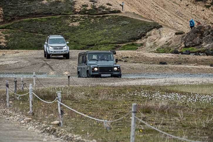
River crossing entering Landmmannaulaugar. Nikon D750, 220 mm (80-400.0 mm ƒ/4.5-5.6) 1/1250 sec ƒ/8 ISO 800
The trip to Landmannalaugar, a famous destination for its hiking trails, is of moderate difficulty, with just a few river crossings that should be no problem for a 4WD. It runs Norh-East on road 26, just off the Ring Road 1, to road F225 and then a full East, for extimated three hours on each way. Take some food supplies with you if you are not on a diet, since there are no stores along the road and the store at Landmannalaugar is not reliable as far as opening hours. You can take a guide at Landmannalaugar for hikings of a few hours to four or more days.

Sandur flowers. Nikon D810, 24 mm (24-120.0 mm ƒ/4) 1/8 sec ƒ/22 ISO 64

Waves of volcanic rocks. Nikon D810, 24 mm (24-120.0 mm ƒ/4) 1/200 sec ƒ/5.6 ISO 64

More waves: soft moss over lava. Nikon D810, 105 mm (24-120.0 mm ƒ/4) 1/200 sec ƒ/5.6 ISO 64

Landmark. Nikon D810, 35 mm (24-120.0 mm ƒ/4) 1/125 sec ƒ/8 ISO 64

Bathing in warm water. Nikon D810, 120 mm (24-120.0 mm ƒ/4) 1/200 sec ƒ/8 ISO 64

The camp site in Landmannalaugar. Nikon D810, 85 mm (24-120.0 mm ƒ/4) 1/200 sec ƒ/8 ISO 250

The long F225 winding through the desert of volcanic gravel. Nikon D810, 24 mm (24-120.0 mm ƒ/4) 1/400 sec ƒ/8 ISO 250

Lava sculpture on roadside. Nikon D810, 85 mm (85 mm ƒ/1.4) 1/250 sec ƒ/8 ISO 250
Hrossaborg Caldera on road F88
The road to the Hrossaborg caldera is an easy approach to off-road driving. It’s a 44 km drive on Ring Road 1 from Lake Myvatn to the F88 intersection. From here it’s just a few kilometers to the volcano with no water in between, excepted just a muddy pot near the site.

That’s what you see when you turn onto gravel road F88. Nikon. D810, 16 mm (16.0 mm ƒ/2.8) 1/320 sec ƒ/8 ISO 64

No kidding. Nikon D810, 62 mm (24-120.0 mm ƒ/4) 1/160 sec ƒ/8 ISO 64

The caldera of the Hrossaborg appears on the distance. Nikon D810, 24 mm (24-120.0 mm ƒ/4) 1/100 sec ƒ/11 ISO 64

Watch that girl!. Nikon D810, 24 mm (14-24.0 mm ƒ/2.8) 1/250 sec ƒ/8 ISO 64

Landmark on the top of the caldera. Nikon D810, 24 mm (24-120.0 mm ƒ/4) 1/125 sec ƒ/8 ISO 64

On the distance, the bridge over the Jökulsá á Fjöllum, uno dei più lunghi fiumi islandesi. Nikon D750, 400 mm (80-400.0 mm ƒ/4.5-5.6) 1/640 sec ƒ/5.6 ISO 100

View from the top of the caldera. Nikon D810, 24 mm (24-120.0 mm ƒ/4) 1/125 sec ƒ/8 ISO 64
Mount Askja on road F88
On the contrary, the drive to Mount Askja is no piece of cake. It runs 87 km on F88 gravel road, in a harsh environment that changes from volcanic gravel to solid lava rock. It is advisable to start early in the day, or the road will seem endless, and always drive in at least a two car convoy. A few water pots and river-crossing will entertain the drivers. Don’t stop at the first camp site but drive to the second parking area, since the trail from there is only 2.5 km, compared to 8 km the other way. Walk through a snowy plateau to the Mount Askja caldera and the lake, where you’ll be admitted to a really unique spectacle.

Nikon D810, 24 mm (24-120.0 mm ƒ/4) 1/200 sec ƒ/8 ISO 64

Nikon D810, 112 mm (24-120.0 mm ƒ/4) 1/200 sec ƒ/8 ISO 64

Nikon D810, 24 mm (24-120.0 mm ƒ/4) 1/200 sec ƒ/9 ISO 64

Nikon D810, 24 mm (24-120.0 mm ƒ/4) 1/200 sec ƒ/9 ISO 64

The skyline of the Herðubreið Volcano accompanies the traveller for most of the trip. Nikon D810, 24 mm (24-120.0 mm ƒ/4) 1/200 sec ƒ/7.1 ISO 64

Nikon D810, 24 mm (24-120.0 mm ƒ/4) 1/200 sec ƒ/8 ISO 64

It is always advisable to drive in at least two cars caravan in the Highlands. Nikon D810, 62 mm (24-120.0 mm ƒ/4) 1/400 sec ƒ/4,5 ISO 64

Nikon D810, 24 mm (24-120.0 mm ƒ/4) 1/160 sec ƒ/8 ISO 64

Hot water in the smaller caldera. Nikon D810, 24 mm (24-120.0 mm ƒ/4) 1/160 sec ƒ/8 ISO 64

The larger caldera mesures approximately 50 kmq in surface. Nikon D810, 16 mm (16 mm ƒ/2,8) 1/160 sec ƒ/8 ISO 64

Nikon D810, 16 mm (16 mm ƒ/2,8) 1/160 sec ƒ/8 ISO 64

Our friends, Miria and Daniele. Nikon D810, 24 mm (24-120.0 mm ƒ/4) 1/80 sec ƒ/8 ISO 64

The Dyngjufjoll Mountains in the sunset. Nikon D810, 120 mm (24-120.0 mm ƒ/4) 1/200 sec ƒ/8 ISO 64

Nikon D810, 40 mm (24-120.0 mm ƒ/4) 1/500 sec ƒ/4.5 ISO 64

Nikon D810, 24 mm (24-120.0 mm ƒ/4) 1/250 sec ƒ/4.5 ISO 400

Back to civilization and a hot meal. Nikon D810, 24 mm (24-120.0 mm ƒ/4) 1/100 sec ƒ/4.5 ISO 400

